

Advanced Certificate in Secure Geospatial Data Storage Methods
Earn an Advanced Certificate in Secure Geospatial Data Storage Methods to master advanced techniques for protecting and managing critical spatial data.
Advanced Certificate in Secure Geospatial Data Storage Methods
Programme Overview
This course is designed for data scientists, GIS professionals, and IT security experts looking to enhance their skills in secure geospatial data storage. Participants will learn advanced methods for securing geospatial data, including encryption techniques, secure data handling protocols, and compliance with privacy regulations.
By the end of the course, learners will gain practical knowledge and hands-on experience in implementing secure storage solutions for geospatial data, ensuring data integrity and confidentiality in various organizational settings.
What You'll Learn
Dive into the cutting-edge world of secure geospatial data storage with our Advanced Certificate in Secure Geospatial Data Storage Methods. This intensive program equips you with the skills to manage sensitive geospatial data securely, ensuring compliance with international standards and regulations. You'll master advanced encryption techniques, data integrity methods, and secure data transfer protocols. Enhance your career prospects in industries ranging from defense and intelligence to urban planning and environmental science. Our hands-on approach includes real-world case studies and projects, preparing you to tackle complex data security challenges. Join a network of professionals dedicated to safeguarding critical information in an increasingly digital landscape. Enroll now and secure your future in data protection.
Programme Highlights
Industry-Aligned Curriculum
Developed with industry leaders to ensure practical, job-ready skills valued by employers worldwide.
Globally Recognised Certificate
Recognised by employers across 180+ countries as a mark of professional excellence.
Flexible Online Learning
Study at your own pace with lifetime access to all course materials and updates.
Instant Access
Start learning immediately — no application process or waiting period required.
Constantly Updated Content
Stay ahead with the latest industry trends, best practices, and emerging insights.
Career Advancement
87% of graduates report measurable career progression within 6 months of completion.
Topics Covered
- 1. Introduction to Geospatial Data: Learners will study the basic concepts of geospatial data, including coordinate systems, projections, and data types. They will gain foundational knowledge to understand how geospatial data is collected, represented, and managed.
- 2. Geospatial Data Security Fundamentals: This module covers the essential principles of secure geospatial data management, including data access controls, encryption methods, and the importance of data integrity.
- 3. Secure Storage Technologies: Learners will explore various secure storage technologies for geospatial data, such as encrypted databases, secure file systems, and cloud storage solutions, and understand their implementation and limitations.
- 4. Identity and Access Management for Geospatial Data: This module focuses on implementing secure identity and access management systems for geospatial data, covering user authentication, authorization, and role-based access control.
- 5. Secure Data Transmission Methods: Learners will study methods to securely transmit geospatial data over networks, including encryption protocols, secure sockets layers (SSL), and transport layer security (TLS).
- 6. Geospatial Data Privacy and Compliance: This module covers legal and ethical considerations in geospatial data management, including compliance with data protection regulations and best practices for handling sensitive data.
- 7. Advanced Encryption Techniques for Geospatial Data: Learners will delve into advanced encryption techniques specifically designed for geospatial data, such as homomorphic encryption and secure multi-party computation.
- 8. Secure Geospatial Data Visualization: This module focuses on creating secure and efficient visual representations of geospatial data, addressing issues related to data privacy, scalability, and performance.
- 9. Disaster Recovery and Business Continuity for Geospatial Data: Learners will learn how to develop disaster recovery plans and business continuity strategies specifically tailored to geospatial data, ensuring data availability and resilience.
- 10. Secure Geospatial Data Auditing and Monitoring: This module covers the implementation of auditing and monitoring tools to ensure the security and integrity of geospatial data, including logging, intrusion detection, and forensic analysis techniques.
What You Get When You Enroll
Secure checkout • Instant access • Certificate included
Key Facts
Audience: Professionals in GIS, data security
Prerequisites: Basic GIS knowledge, foundational IT skills
Outcomes: Understand secure storage methods, implement data encryption techniques, assess security risks
Ready to get started?
Join thousands of professionals who already took the next step. Enroll now and get instant access.
Enroll Now — $149Why This Course
Enhances security expertise by focusing on advanced methods to protect geospatial data.
Provides practical skills in secure data storage, vital for professionals in geographic information systems (GIS).
Aligns with industry standards, offering certification that is highly valued in the geospatial sector.
Your Path to Certification
Trusted by Professionals Worldwide
Course Brochure
Download our comprehensive course brochure with all details
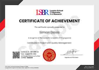
Sample Certificate
Preview the certificate you'll receive upon successful completion of this program.
Get Free Course Info
Enter your details and we'll send you a comprehensive course information pack straight to your inbox.
Employer Sponsored Training
Let your employer invest in your professional development. Request a corporate invoice and get your training funded.
Request Corporate InvoiceWhat People Say About Us
Hear from our students about their experience with the Advanced Certificate in Secure Geospatial Data Storage Methods at FlexiCourses.
Sophie Brown
United Kingdom"The course content is incredibly detailed and relevant, providing a solid foundation in secure geospatial data storage methods that have directly enhanced my ability to handle sensitive location-based information securely. Gaining these practical skills has been invaluable for my career, opening up new opportunities in data security and management."
Arjun Patel
India"This course has been incredibly valuable, equipping me with advanced techniques for secure geospatial data storage that are directly applicable in the field. It has not only enhanced my technical skills but also opened up new career opportunities in data security and geospatial analysis."
Tyler Johnson
United States"The course structure is well-organized, providing a clear path from basic concepts to advanced secure geospatial data storage methods, which has significantly enhanced my understanding and practical skills in handling sensitive geographic information securely."