

Executive Development Programme in Emergency Response Planning Using GIS
This programme enhances leaders' skills in developing effective emergency response plans through Geographic Information Systems (GIS), improving situational awareness and decision-making.
Executive Development Programme in Emergency Response Planning Using GIS
Programme Overview
This course is designed for senior executives and managers in government, NGO, and corporate sectors responsible for emergency response planning. Participants will gain expertise in utilizing Geographic Information Systems (GIS) to enhance decision-making during crises, improve resource allocation, and develop robust emergency management strategies. They will learn to integrate GIS technologies with traditional emergency response methods to create more effective and efficient plans.
Upon completion, learners will be able to leverage GIS tools for spatial analysis, risk assessment, and scenario modeling. The course equips them with the skills to lead their organizations in preparing for, responding to, and recovering from natural disasters and other emergencies.
What You'll Learn
Explore the critical intersection of leadership and geographic information systems (GIS) in emergency response planning with our Executive Development Programme. This transformative course equips you with the advanced skills needed to manage crises efficiently and effectively. You'll learn to leverage GIS technology for data analysis, decision-making, and strategic planning in real-world scenarios. With a focus on practical applications, this program offers case studies, live projects, and expert mentoring from renowned GIS professionals and emergency management leaders.
This program opens doors to executive roles in government, non-profit organizations, and private sectors, where you can lead emergency response efforts and shape policies. Join us and become a visionary leader in safeguarding communities and enhancing global resilience.
Programme Highlights
Industry-Aligned Curriculum
Developed with industry leaders to ensure practical, job-ready skills valued by employers worldwide.
Globally Recognised Certificate
Recognised by employers across 180+ countries as a mark of professional excellence.
Flexible Online Learning
Study at your own pace with lifetime access to all course materials and updates.
Instant Access
Start learning immediately — no application process or waiting period required.
Constantly Updated Content
Stay ahead with the latest industry trends, best practices, and emerging insights.
Career Advancement
87% of graduates report measurable career progression within 6 months of completion.
Topics Covered
- 1. Introduction to Emergency Response Planning: Learners will study the basic principles of emergency response planning and the role of GIS in disaster management. They will gain foundational knowledge of GIS tools and techniques relevant to emergency response scenarios.
- 2. GIS Fundamentals for Emergency Response: This module covers essential GIS concepts such as spatial data types, coordinate systems, and data layers. Learners will practice using GIS software to analyze and visualize spatial data related to emergency response.
- 3. Data Collection and Management for Emergency Response: Learners will explore methods for collecting and managing spatial and non-spatial data pertinent to emergency response. Practical skills include data entry, quality control, and data integration using GIS.
- 4. Risk Assessment Using GIS: This module focuses on using GIS to assess risks associated with various hazards. Learners will learn to perform risk analyses, create risk maps, and interpret spatial data to inform decision-making in emergency response planning.
- 5. Emergency Planning and Resource Allocation: Learners will study strategies for planning and allocating resources effectively during emergencies. Practical skills include creating resource allocation models and using GIS to optimize resource distribution.
- 6. GIS in Communication and Coordination: This module addresses the role of GIS in communication and coordination during emergency response. Learners will create and use dynamic maps, develop communication strategies, and enhance situational awareness through GIS.
- 7. Decision Support Systems for Emergency Response: Learners will delve into advanced GIS-based decision support systems. Practical skills include developing customized decision support tools and using GIS to assist in complex emergency response scenarios.
- 8. GIS in Post-Disaster Management: This module covers the use of GIS in post-disaster recovery and reconstruction efforts. Learners will learn to assess damage, plan for recovery, and monitor progress using GIS technologies.
- 9. Advanced GIS Techniques for Emergency Response: This advanced module explores cutting-edge GIS techniques and tools for emergency response. Practical skills include using machine learning and spatial analytics to improve emergency response planning and operations.
- 10. Case Studies and Best Practices in Emergency Response Planning Using GIS: Learners will analyze real-world case studies and best practices from emergency response planning using GIS. This module aims to provide practical insights and strategies for effective emergency response planning.
What You Get When You Enroll
Secure checkout • Instant access • Certificate included
Key Facts
Audience: Emergency responders, planners
Prerequisites: Basic GIS knowledge
Outcomes: Enhanced planning skills, GIS proficiency
Ready to get started?
Join thousands of professionals who already took the next step. Enroll now and get instant access.
Enroll Now — $199Why This Course
Gain specialized skills in integrating GIS for effective emergency response planning.
Enhance strategic decision-making through advanced spatial analysis techniques.
Network with professionals from diverse sectors, fostering collaborative opportunities.
Your Path to Certification
Trusted by Professionals Worldwide
Course Brochure
Download our comprehensive course brochure with all details
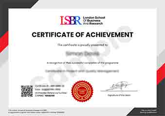
Sample Certificate
Preview the certificate you'll receive upon successful completion of this program.
Get Free Course Info
Enter your details and we'll send you a comprehensive course information pack straight to your inbox.
Employer Sponsored Training
Let your employer invest in your professional development. Request a corporate invoice and get your training funded.
Request Corporate InvoiceWhat People Say About Us
Hear from our students about their experience with the Executive Development Programme in Emergency Response Planning Using GIS at FlexiCourses.
Sophie Brown
United Kingdom"The course provided high-quality, detailed material that significantly enhanced my understanding of emergency response planning using GIS. I gained valuable practical skills that I can directly apply in my role, making me more effective in managing potential crises."
Priya Sharma
India"This course has been incredibly valuable, equipping me with advanced GIS skills that are directly applicable in emergency response scenarios. It has not only enhanced my technical abilities but also opened up new career opportunities in the field of disaster management."
Jack Thompson
Australia"The course structure is well-organized, providing a clear path from basic GIS concepts to advanced emergency response strategies, which has significantly enhanced my understanding and practical skills in this field. The comprehensive content and real-world applications have been particularly beneficial for my professional growth, equipping me with tools to effectively plan and manage emergency responses."