

Executive Development Programme in Geospatial Data Analysis and Mapping with R
This program enhances leadership skills in geospatial data analysis and mapping using R, equipping professionals with advanced techniques for data visualization and spatial analysis.
Executive Development Programme in Geospatial Data Analysis and Mapping with R
Programme Overview
This course is designed for mid-to-senior level executives in industries such as urban planning, environmental management, and geographic information systems (GIS). It equips participants with advanced skills in geospatial data analysis and mapping using R, a powerful open-source programming language. Participants will gain the ability to handle large datasets, perform complex spatial analysis, and create detailed maps and visualizations to support strategic decision-making.
By the end of the program, attendees will be proficient in using R packages like ggplot2, sf, and sp, and will understand how to integrate geospatial data into their business processes to enhance operational efficiency and inform data-driven strategies.
What You'll Learn
Dive into the transformative world of geospatial data analysis and mapping with our Executive Development Programme in Geospatial Data Analysis and Mapping with R. This cutting-edge course equips you with advanced skills to visualize, analyze, and interpret geospatial data using the powerful R programming language. You'll learn to harness the potential of geospatial technologies to drive business decision-making and innovation across sectors like urban planning, environmental science, and public health. Real-world projects and case studies provide hands-on experience, while expert guidance from industry leaders prepares you for a dynamic career in data science. Elevate your career and unlock new opportunities to make a meaningful impact with data-driven solutions!
Programme Highlights
Industry-Aligned Curriculum
Developed with industry leaders to ensure practical, job-ready skills valued by employers worldwide.
Globally Recognised Certificate
Recognised by employers across 180+ countries as a mark of professional excellence.
Flexible Online Learning
Study at your own pace with lifetime access to all course materials and updates.
Instant Access
Start learning immediately — no application process or waiting period required.
Constantly Updated Content
Stay ahead with the latest industry trends, best practices, and emerging insights.
Career Advancement
87% of graduates report measurable career progression within 6 months of completion.
Topics Covered
- 1. Geospatial Fundamentals: Learners will study the basics of geospatial data, including data types, coordinate systems, and projections. They will gain foundational skills in understanding and working with geospatial data.
- 2. Data Acquisition and Management: Learners will explore methods for acquiring geospatial data from various sources and learn how to manage and organize this data effectively for analysis.
- 3. Introduction to R for Geospatial Analysis: This module introduces learners to R programming, specifically focusing on libraries and tools essential for geospatial data analysis.
- 4. Geospatial Data Cleaning and Preprocessing: Learners will learn techniques for cleaning and preprocessing geospatial data to ensure accuracy and reliability in subsequent analyses.
- 5. Spatial Data Visualization with R: This module covers the creation of maps and other visualizations using R packages, enabling learners to effectively communicate geospatial data insights.
- 6. Advanced Geospatial Analysis Techniques: Learners will delve into advanced analytical techniques such as spatial autocorrelation, hotspot analysis, and cluster detection.
- 7. Remote Sensing and Geospatial Analysis: This module provides an introduction to remote sensing technologies and how they can be integrated with R for geospatial analysis.
- 8. Geospatial Modeling and Simulation: Learners will study various modeling techniques and simulations used in geospatial analysis, including spatial regression and agent-based modeling.
- 9. Big Data and Geospatial Analysis: This module explores how to handle and analyze large geospatial datasets using R, focusing on big data technologies and scalable computing solutions.
- 10. Project Management and Reporting: Learners will work on a comprehensive project that integrates all learned skills, culminating in a professional report and presentation of findings.
What You Get When You Enroll
Secure checkout • Instant access • Certificate included
Key Facts
Target professionals in GIS
Basic R programming knowledge required
Master geospatial data analysis techniques
Develop mapping skills with R
Enhance data visualization capabilities
Ready to get started?
Join thousands of professionals who already took the next step. Enroll now and get instant access.
Enroll Now — $199Why This Course
This program equips learners with advanced skills in geospatial data analysis and mapping using R, a powerful programming language widely used in the industry.
Participants gain practical experience through real-world projects, enhancing their ability to solve complex spatial data challenges.
The program offers networking opportunities with industry professionals, facilitating career growth and knowledge sharing.
Your Path to Certification
Trusted by Professionals Worldwide
Course Brochure
Download our comprehensive course brochure with all details
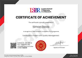
Sample Certificate
Preview the certificate you'll receive upon successful completion of this program.
Get Free Course Info
Enter your details and we'll send you a comprehensive course information pack straight to your inbox.
Employer Sponsored Training
Let your employer invest in your professional development. Request a corporate invoice and get your training funded.
Request Corporate InvoiceWhat People Say About Us
Hear from our students about their experience with the Executive Development Programme in Geospatial Data Analysis and Mapping with R at FlexiCourses.
James Thompson
United Kingdom"The course content was incredibly thorough and well-structured, providing a solid foundation in geospatial data analysis and mapping techniques using R. Gaining hands-on experience with real-world datasets significantly enhanced my practical skills, making me more competitive in the job market."
Hans Weber
Germany"The Executive Development Programme in Geospatial Data Analysis and Mapping with R has significantly enhanced my ability to analyze complex data and create insightful maps, making me a more valuable asset in my organization. This course has not only deepened my technical skills but also provided me with practical tools that are highly relevant in the current industry landscape, opening up new opportunities for career advancement."
Greta Fischer
Germany"The course structure was meticulously organized, providing a seamless transition from basic concepts to advanced geospatial data analysis techniques, which significantly enhanced my understanding and practical skills in mapping with R. The comprehensive content and real-world applications have been instrumental in my professional growth, equipping me with the tools to tackle complex geospatial projects effectively."