

Executive Development Programme in Geospatial Data Compatibility Across Vendors
This programme enhances leadership skills in aligning geospatial data across vendors for seamless integration and improved decision-making.
Executive Development Programme in Geospatial Data Compatibility Across Vendors
Programme Overview
This course is designed for senior executives and decision-makers in geospatial technology and related industries. It aims to enhance their understanding of current geospatial data standards and interoperability challenges across various vendor platforms. Participants will gain insights into best practices for ensuring seamless data exchange, reducing integration costs, and staying compliant with emerging industry standards.
By the end of the program, attendees will be equipped with the knowledge to drive strategic decisions that promote data compatibility, foster vendor partnerships, and improve overall organizational efficiency in handling geospatial data.
What You'll Learn
Embark on a transformative journey to master the art of integrating geospatial data across various vendor platforms with our Executive Development Programme. This cutting-edge course equips you with the skills to navigate complex data landscapes, ensuring seamless interoperability for enhanced decision-making in your organization. You'll gain invaluable insights into industry standards, data management best practices, and vendor-specific solutions. As a graduate, you'll open doors to advanced career opportunities, including data analytics leadership roles, geospatial project management, and consulting positions. Dive into real-world case studies, hands-on workshops, and expert mentorship to build a robust skill set that transforms data into strategic advantages. Join us to lead the evolution of geospatial data compatibility and shape the future of your industry.
Programme Highlights
Industry-Aligned Curriculum
Developed with industry leaders to ensure practical, job-ready skills valued by employers worldwide.
Globally Recognised Certificate
Recognised by employers across 180+ countries as a mark of professional excellence.
Flexible Online Learning
Study at your own pace with lifetime access to all course materials and updates.
Instant Access
Start learning immediately — no application process or waiting period required.
Constantly Updated Content
Stay ahead with the latest industry trends, best practices, and emerging insights.
Career Advancement
87% of graduates report measurable career progression within 6 months of completion.
Topics Covered
- 1. Introduction to Geospatial Data: Learners will study the fundamentals of geospatial data, including types, sources, and basic principles. They will gain skills in identifying and describing different geospatial data formats.
- 2. Geospatial Data Standards: This module covers standardization efforts in the geospatial industry, including OGC standards, and how they ensure interoperability between different vendors. Learners will learn to recognize and apply geospatial data standards.
- 3. Data Integration Techniques: Learners will explore various techniques for integrating geospatial data from multiple sources, focusing on methods that ensure data compatibility and accuracy. Practical skills include using software tools for data fusion and validation.
- 4. Geospatial Metadata Management: This module delves into the importance of metadata in managing geospatial data, including best practices and tools for metadata creation and management. Learners will develop skills in creating and maintaining comprehensive metadata descriptions.
- 5. Vendor-Specific Geospatial Data Formats: An in-depth look at the proprietary data formats used by major geospatial vendors, including ESRI, QGIS, and others. Learners will learn how to convert between different formats and understand their implications for data interoperability.
- 6. Geospatial Data Quality Assurance: This module focuses on assessing and improving the quality of geospatial data. Learners will study key quality metrics and tools for data validation, and gain skills in implementing quality assurance processes.
- 7. Advanced Geospatial Data Transformation: Advanced techniques for transforming geospatial data to ensure compatibility across different systems and platforms. Topics include coordinate system transformations, re-projection, and data normalization. Practical exercises will help learners apply these techniques.
- 8. Geospatial Data Security and Privacy: An exploration of security and privacy concerns in geospatial data management. Learners will learn about data encryption, anonymization techniques, and best practices for securing geospatial data assets.
- 9. Geospatial Data Visualization: This module covers the latest tools and techniques for visualizing geospatial data. Learners will gain skills in creating effective maps and spatial visualizations, and understand how to communicate complex spatial information to stakeholders.
- 10. Case Studies in Geospatial Data Compatibility: Real-world case studies examining challenges and solutions in achieving geospatial data compatibility across vendors. Learners will analyze these cases to deepen their understanding of practical applications and best practices.
What You Get When You Enroll
Secure checkout • Instant access • Certificate included
Key Facts
Audience: Senior geospatial professionals
Prerequisites: Basic geospatial knowledge
Outcomes: Enhanced vendor compatibility skills
Outcomes: Improved data integration capabilities
Outcomes: Stronger project management skills
Ready to get started?
Join thousands of professionals who already took the next step. Enroll now and get instant access.
Enroll Now — $199Why This Course
Gain expertise in integrating geospatial data across various vendors, enhancing project efficiency and outcomes.
Access industry-specific training and networking opportunities, connecting with professionals and leaders in the field.
Stay ahead in the rapidly evolving geospatial technology landscape, ensuring your skills remain relevant and competitive.
Your Path to Certification
Trusted by Professionals Worldwide
Course Brochure
Download our comprehensive course brochure with all details
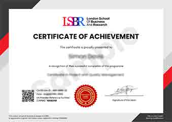
Sample Certificate
Preview the certificate you'll receive upon successful completion of this program.
Get Free Course Info
Enter your details and we'll send you a comprehensive course information pack straight to your inbox.
Employer Sponsored Training
Let your employer invest in your professional development. Request a corporate invoice and get your training funded.
Request Corporate InvoiceWhat People Say About Us
Hear from our students about their experience with the Executive Development Programme in Geospatial Data Compatibility Across Vendors at FlexiCourses.
James Thompson
United Kingdom"The course provided in-depth material on geospatial data standards, which significantly enhanced my ability to manage data across different vendors. I gained practical skills that are directly applicable in my role, making me more efficient and valuable to my team."
Oliver Davies
United Kingdom"The Executive Development Programme in Geospatial Data Compatibility Across Vendors has significantly enhanced my ability to work with diverse data systems, making me a more valuable asset in my organization. This course has not only deepened my technical skills but also provided me with practical insights that are directly applicable in real-world scenarios, opening up new opportunities for career advancement."
Fatimah Ibrahim
Malaysia"The course structure was meticulously organized, making it easy to follow and ensuring a smooth progression from foundational concepts to advanced topics in geospatial data compatibility. The comprehensive content not only deepened my understanding but also provided valuable insights into real-world applications, significantly enhancing my professional skills."