

Executive Development Programme in Preserving Geospatial Data for Future Use
This program equips executives with advanced skills to manage and preserve geospatial data, ensuring long-term accessibility and strategic decision-making.
Executive Development Programme in Preserving Geospatial Data for Future Use
Programme Overview
The 'Executive Development Programme in Preserving Geospatial Data for Future Use' targets professionals in data management, GIS, and related fields. This means anyone who handles geospatial data and wants to ensure its longevity and accessibility. The course equips participants with advanced skills and strategies to maintain, manage and preserve geospatial data. Moreover, it covers current best practices and emerging technologies.
Participants will gain hands-on experience. Firstly, they will learn to apply effective data preservation techniques. Secondly, they will master data governance frameworks. Lastly, they will understand the importance of data ethics and privacy. By the end, attendees will be able to lead their organizations in preserving geospatial data effectively, ensuring it remains valuable and accessible for future use.
What You'll Learn
Unlock your potential in the dynamic field of geospatial data with our Executive Development Programme in Preserving Geospatial Data for Future Use. This comprehensive course empowers professionals to safeguard valuable geospatial information for tomorrow's challenges. First, you will dive into the fundamentals of geospatial data management. Next, you will master cutting-edge preservation techniques. Moreover, you will gain hands-on experience with industry-leading tools.
This program is designed for professionals seeking to advance their careers. Whether you are in urban planning, environmental science, or data analytics, this course equips you with the skills to protect and utilize geospatial data effectively. Additionally, you will learn from industry experts and engage in collaborative projects. Most importantly, you will develop a network of like-minded professionals.
By the end of this program, you will be ready to lead initiatives that ensure geospatial data remains accessible and useful for future generations. Enroll today and take the first step towards becoming a guardian of our spatial legacy.
Programme Highlights
Industry-Aligned Curriculum
Developed with industry leaders to ensure practical, job-ready skills valued by employers worldwide.
Globally Recognised Certificate
Recognised by employers across 180+ countries as a mark of professional excellence.
Flexible Online Learning
Study at your own pace with lifetime access to all course materials and updates.
Instant Access
Start learning immediately — no application process or waiting period required.
Constantly Updated Content
Stay ahead with the latest industry trends, best practices, and emerging insights.
Career Advancement
87% of graduates report measurable career progression within 6 months of completion.
Topics Covered
- Geospatial Data Fundamentals: Understand the basics of geospatial data and its applications.
- Data Collection Techniques: Learn methods for collecting accurate and reliable geospatial data.
- Data Management and Storage: Explore strategies for organizing and storing geospatial data efficiently.
- Data Preservation Strategies: Implement techniques to ensure the longevity and usability of geospatial data.
- Ethical and Legal Considerations: Examine the ethical guidelines and legal frameworks governing geospatial data use.
- Future Trends in Geospatial Technology: Discover emerging technologies and their impact on geospatial data preservation.
What You Get When You Enroll
Secure checkout • Instant access • Certificate included
Key Facts
Audience
Professionals handling geospatial data in the public and private sectors.
This includes geospatial analysts, urban planners, and environmental scientists.
Moreover, those who are interested in learning how to preserve geospatial data.
Prerequisites
Basic knowledge of geospatial concepts.
Participants should be familiar with GIS software.
Furthermore, a desire to actively engage in learning sessions.
Outcomes
Firstly, participants will learn to develop preservation strategies.
Secondly, they will gain skills in data management.
Then, participants will be able to assess data risks.
Lastly, they will understand the importance of preserving data for future use.
Ready to get started?
Join thousands of professionals who already took the next step. Enroll now and get instant access.
Enroll Now — $199Why This Course
Learners should pick the 'Executive Development Programme in Preserving Geospatial Data for Future Use' for several compelling reasons. Firstly, this program actively equips participants with essential skills. These skills enable learners to manage and preserve geospatial data effectively. Consequently, graduates can actively contribute to informed decision-making processes. Secondly, the program fosters connections with professionals in the field. Furthermore, these connections allow for networking opportunities. Additionally, learners can gain valuable insights from industry experts. Lastly, the program emphasizes hands-on learning. This approach ensures that participants gain practical experience. Moreover, this experience is crucial for applying theoretical knowledge in real-world scenarios.
Your Path to Certification
Trusted by Professionals Worldwide
Course Brochure
Download our comprehensive course brochure with all details
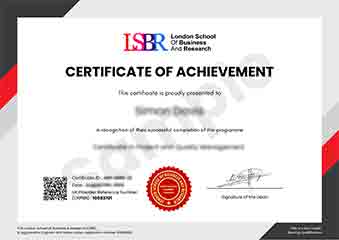
Sample Certificate
Preview the certificate you'll receive upon successful completion of this program.
Get Free Course Info
Enter your details and we'll send you a comprehensive course information pack straight to your inbox.
Employer Sponsored Training
Let your employer invest in your professional development. Request a corporate invoice and get your training funded.
Request Corporate InvoiceWhat People Say About Us
Hear from our students about their experience with the Executive Development Programme in Preserving Geospatial Data for Future Use at FlexiCourses.
Oliver Davies
United Kingdom"The course content was incredibly comprehensive, covering everything from the basics of geospatial data to advanced preservation techniques. I gained practical skills in data management and analysis that I've already started applying in my current role, making me more confident in handling geospatial information for long-term projects."
Oliver Davies
United Kingdom"The Executive Development Programme in Preserving Geospatial Data for Future Use has significantly enhanced my ability to manage and analyze geospatial information, making me a more valuable asset in my current role. The course's emphasis on practical applications and industry relevance has not only improved my technical skills but also opened up new opportunities for career advancement in the field of geospatial data management."
Emma Tremblay
Canada"The course was exceptionally well-organized, with a clear progression from fundamental concepts to advanced techniques in geospatial data preservation. The comprehensive content not only deepened my understanding but also provided practical insights into real-world applications, significantly enhancing my professional growth in this field."