

Postgraduate Certificate in Querying Spatial Data in Python
Gain expertise in querying spatial data using Python for advanced data analysis and visualization.
Postgraduate Certificate in Querying Spatial Data in Python
Programme Overview
This course is designed for professionals and students with a basic understanding of Python who wish to enhance their skills in querying spatial data. Participants will learn to effectively use Python libraries such as geopandas and Fiona to manipulate and analyze spatial datasets, and will gain proficiency in creating and executing spatial queries.
By the end of the course, learners will be capable of handling real-world spatial data challenges, from importing geospatial data to performing complex spatial analyses and visualizations.
What You'll Learn
Explore the fascinating world of spatial data analysis with our Postgraduate Certificate in Querying Spatial Data in Python. Dive into GIS technology using Python, a powerful tool for handling complex geospatial information. This course equips you with essential skills to analyze, manipulate, and visualize spatial data, making you a sought-after expert in fields like urban planning, environmental science, and logistics. Learn to tackle real-world challenges, from mapping natural disasters to optimizing delivery routes. By the end of this program, you'll be proficient in Python libraries such as geopandas and shapely, opening doors to diverse career opportunities in both public and private sectors. Join us and unlock the potential of spatial data to drive innovation and make a meaningful impact.
Programme Highlights
Industry-Aligned Curriculum
Developed with industry leaders to ensure practical, job-ready skills valued by employers worldwide.
Globally Recognised Certificate
Recognised by employers across 180+ countries as a mark of professional excellence.
Flexible Online Learning
Study at your own pace with lifetime access to all course materials and updates.
Instant Access
Start learning immediately — no application process or waiting period required.
Constantly Updated Content
Stay ahead with the latest industry trends, best practices, and emerging insights.
Career Advancement
87% of graduates report measurable career progression within 6 months of completion.
Topics Covered
- 1. Foundations of Spatial Data: Learners will study the basics of spatial data, including types of spatial data, coordinate systems, and spatial data models. They will gain foundational skills in understanding and working with geographic information systems (GIS) data.
- 2. Python for Data Handling: This module focuses on using Python for data handling tasks relevant to spatial data, including file I/O operations, data structures, and basic data manipulation. Learners will develop skills in managing and preparing spatial data for analysis.
- 3. Geopandas and Pandas Integration: Students will learn to integrate geospatial and non-geospatial data using Geopandas, a powerful Python library. They will enhance their ability to manipulate and analyze spatial data using both geospatial and tabular data formats.
- 4. Introduction to Spatial Analysis: This module introduces basic spatial analysis techniques, including distance calculations, spatial joins, and buffering. Learners will gain practical skills in performing spatial analysis to extract meaningful insights from spatial data.
- 5. Spatial Statistics: Advanced spatial statistics techniques, such as spatial autocorrelation and kriging, will be explored. Learners will learn to apply statistical methods to understand patterns and relationships in spatial data.
- 6. Geospatial Visualization: Using libraries like Matplotlib, Folium, and GeoPandas, learners will develop skills in creating visual representations of spatial data. This module focuses on effective communication of spatial analysis results through data visualization.
- 7. Web Mapping with Folium: This module covers the creation of interactive web maps using the Folium library. Learners will learn to integrate geospatial data into web applications, enhancing their ability to share spatial analysis results with a broader audience.
- 8. Advanced Python Techniques for Spatial Data: Advanced Python programming techniques, such as object-oriented programming and decorators, will be applied to spatial data handling. This module focuses on optimizing and enhancing spatial data processing workflows.
- 9. Spatial Data Integration and Management: Learners will study best practices for integrating and managing large spatial datasets, including data normalization, schema design, and version control. They will gain skills in efficient spatial data management.
- 10. Final Project: In this capstone module, learners will apply all the skills acquired throughout the course to a real-world spatial data analysis project. They will work on a comprehensive project that demonstrates their ability to handle, analyze, and visualize spatial data using Python.
What You Get When You Enroll
Secure checkout • Instant access • Certificate included
Key Facts
For working professionals, students
Basic Python programming knowledge
Master spatial data querying techniques
Apply Python to real-world scenarios
Gain proficiency with libraries like GeoPandas
Ready to get started?
Join thousands of professionals who already took the next step. Enroll now and get instant access.
Enroll Now — $149Why This Course
Develop specialized skills in handling and analyzing spatial data using Python, enhancing career prospects in fields like urban planning, environmental science, and GIS.
Gain practical experience with spatial data querying tools, preparing you to solve complex spatial analysis problems efficiently.
Access cutting-edge learning materials and support from experts, ensuring you stay updated with the latest techniques and best practices in spatial data querying.
Your Path to Certification
Trusted by Professionals Worldwide
Course Brochure
Download our comprehensive course brochure with all details
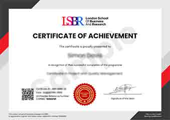
Sample Certificate
Preview the certificate you'll receive upon successful completion of this program.
Get Free Course Info
Enter your details and we'll send you a comprehensive course information pack straight to your inbox.
Employer Sponsored Training
Let your employer invest in your professional development. Request a corporate invoice and get your training funded.
Request Corporate InvoiceWhat People Say About Us
Hear from our students about their experience with the Postgraduate Certificate in Querying Spatial Data in Python at FlexiCourses.
Sophie Brown
United Kingdom"The course content is exceptionally well-structured, providing a deep dive into querying spatial data with Python, which has significantly enhanced my ability to analyze geographical information effectively. Gaining these practical skills has opened up new opportunities in my field, making me more competitive for advanced positions."
Klaus Mueller
Germany"This course has been instrumental in enhancing my ability to work with spatial data, making me a more competitive candidate in the job market. The practical applications in Python have directly translated into more efficient and effective solutions in my current role."
Charlotte Williams
United Kingdom"The course structure is well-organized, providing a clear path from basic concepts to advanced querying techniques, which significantly enhances my ability to handle spatial data in real-world applications. It has been incredibly beneficial for my professional growth, equipping me with the skills needed to analyze and visualize geographical information effectively."